Everest Base Camp, Three Passes Trek, Travel
To Lobuche over the Kongma La Pass, Everest Base Camp Honeymoon (Day Ten)
DESTINATION: Lobuche
ELEVATION: 4,940 meters
ELEVATION GAIN: + 340 meters
DISTANCE: about 10 km (7 hours of walking , but it took us 11)
OXYGEN: 56% of sea level (previous 57%)
ELEVATION (Kongma La Pass): 5,535 meters – the highest of three passes
OXYGEN: 52% of sea level (previous 57%)
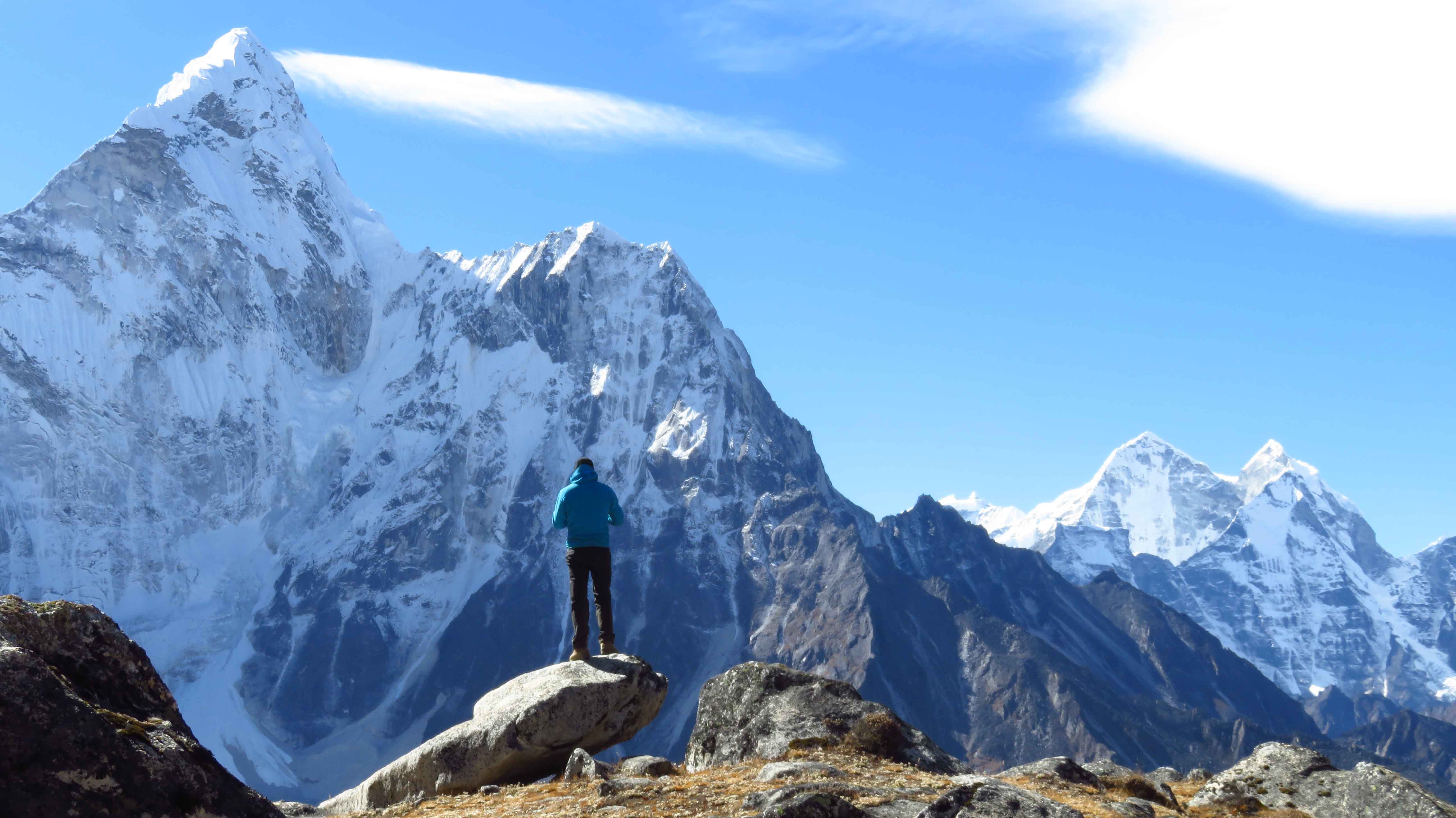
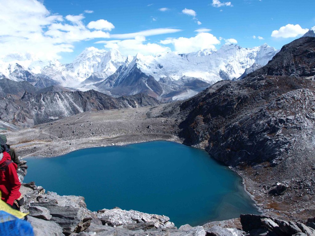
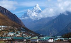
Kongma La Pass is the highest of the three passes crossing over 5,535 meters. At that altitude, you only get 52% of sea-level oxygen, making it harder to breathe. It’s undoubtedly one of the hardest hiking treks, and some say the hardest of the three passes. As you stand at the top of the world, soaking in the views of the magnificent Himalayan giants Cholatse, Lobuche, Nuptse, Imja Tse, Lhotse, and Ama Dablam, the struggle to reach the top seems so faint in comparison with the reward.
The Kongma La Pass, Three Passes Trek in Nepal
There are two ways to trek the Three Passe trek: Starting with the Renjo La Pass and finishing with the Kongma La Pass or starting with the Kongma La Pass (although both ways begin in Lukla you can choose to go clockwise or counterclockwise.) We began with Kongma La as this made our ascent more gradual and the descent less steep.
After resting for a few days in Chukhung, we headed out to conquer our first pass. In Chukhung, we were lucky to secure a porter for USD 50 to cross our bags to the other side. Porters don’t go over the passes (when possible) to avoid altitude sickness; instead, they choose routes around. The one going around the Kongma La Pass is about 22 km and would take these experienced guys only five hours or less. Pretty impressive!
According to the Lonely Planet, the Kongma La Pass takes about seven (7) hours to cross. That’s also what most blogs mentioned; however, it took us almost 11 hours to reach Lobuche at a slower pace. We took lots of breaks as I struggled with mild AMS, and we got slightly off-trail on the final push of the trek – the glacier crossing.
Travel Tip: According to the stories we heard from the locals and other travellers, it’s not unusual for hikers to get lost on this trek if travelling without a guide. Most of the path is relatively easy to find, but the moraine crossing part can get tricky. The Lonely Planet Guide, though, did a pretty good job of indicating where the route is and how to find it. However, in October, it gets dark quickly in the High Himalayas, so planning and securing enough time is important. It’s not recommended to attempt to cross the moraine as it’s getting dark if you’re travelling without a guide. Some travellers choose to break the crossing into two days (we did that for the Cho La Pass).
Finding the Kongma La Pass trail
In the first 15 minutes, the trail behind the village splits into two paths.
Both paths are marked as the trail path, so it gets confusing. However, we took the trail that went straight up, and the other group went around, and we all met at the top. It turns out the path splits and then reunites, so don’t panic when you see the split as it will merge into one eventually.
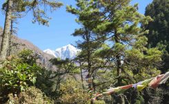
This first part of the trek is not that tough, but the air is pretty thin at this height, so you’ll feel it. Until you start your ascent, the path is relatively flat and easy to walk (no boulders). And as you slowly gain elevation, you’re rewarded with the Himalayan mountains’ views peaking from all around. Until this point, we still haven’t seen Mount Everest. However, we were told that you could see it starting from Namche, depending on the weather.
The Ascent of the Kongma La Pass
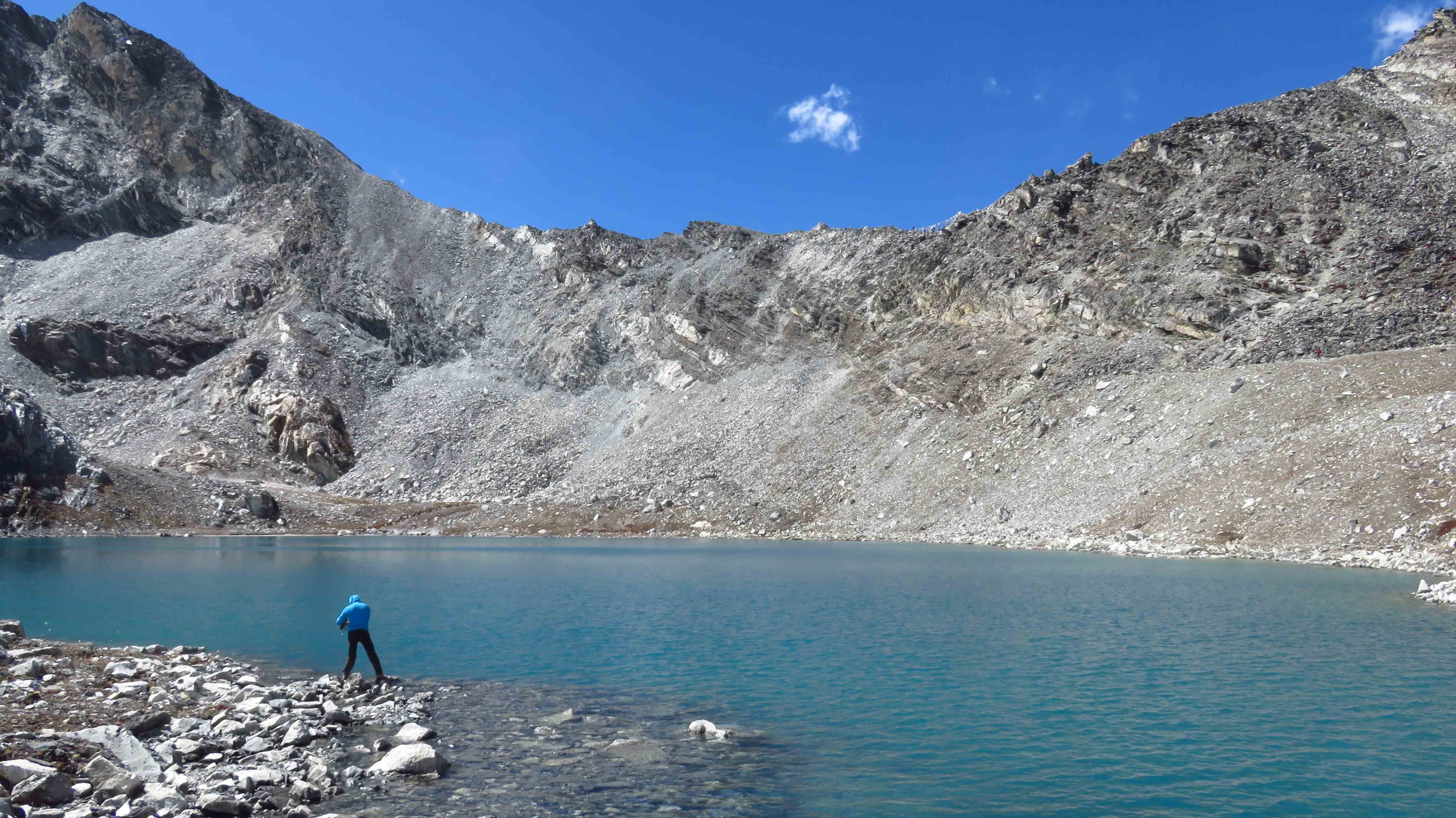
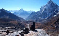
Once at the Kongma La Pass Lake, we took a small break at a beautiful glacial lake, refilled our water bottles for the ascent and identified the route up. This is the second part, where the path gets confusing. However, if you take a few moments to determine the route up, it’s not that hard. Although it may seem like the right way is straight up, the trail path is actually to your right. You should be able to see a faint path made up of loose rock to your right zigzagging around boulders.
It may seem like a short way up, but the ascent is brutal. As this is the highest pass, and the first time you’ll be exposed to such heights on this trek (if you’re following our route), every step becomes very challenging, and any weight you’re carrying will make it so much worse. After what seemed like an eternity for me, we finally made it up to the top and claimed ourselves a beautiful lunch spot to rest and get acclimatized while we’re at it.
The never ending way down…
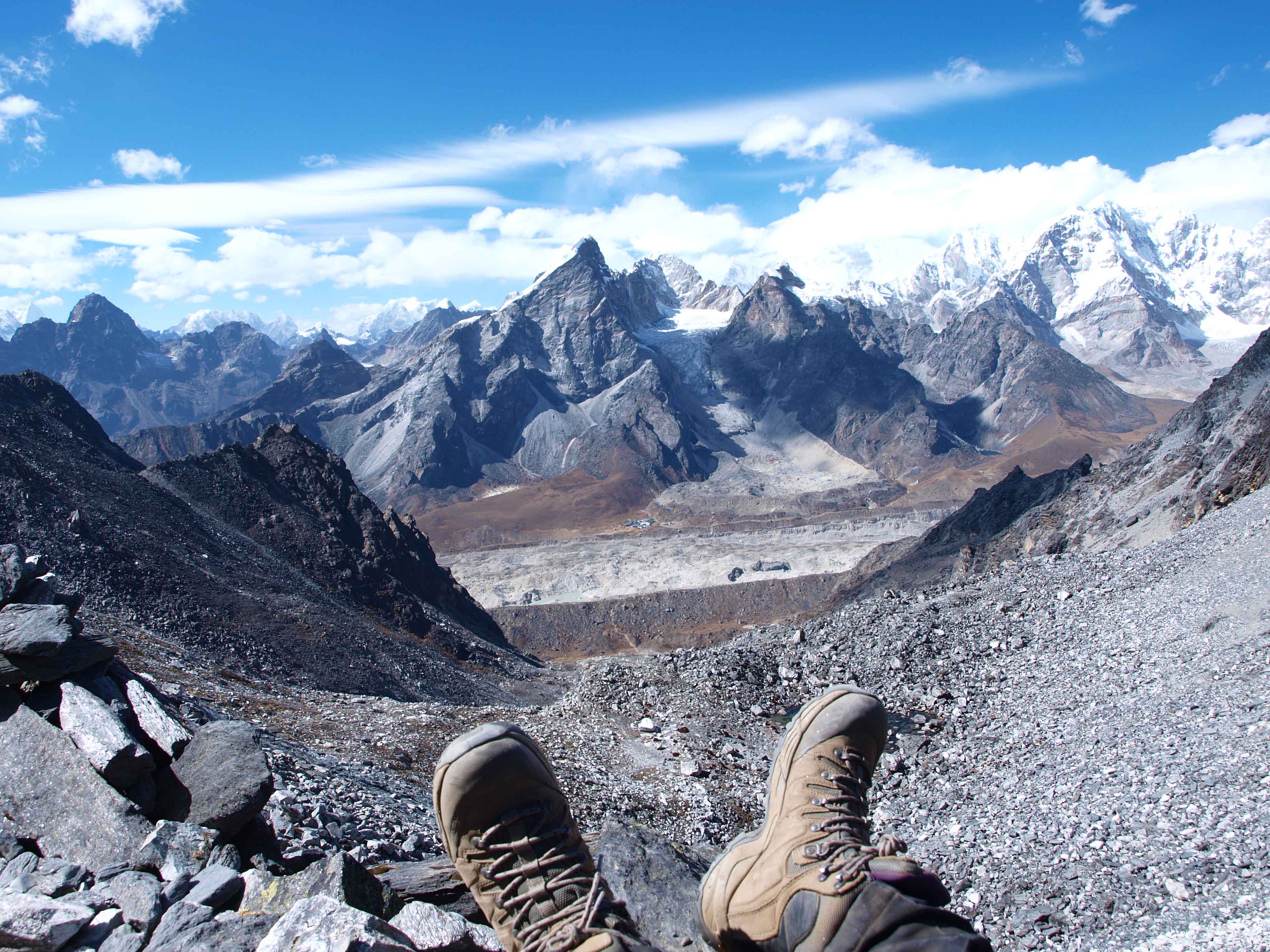
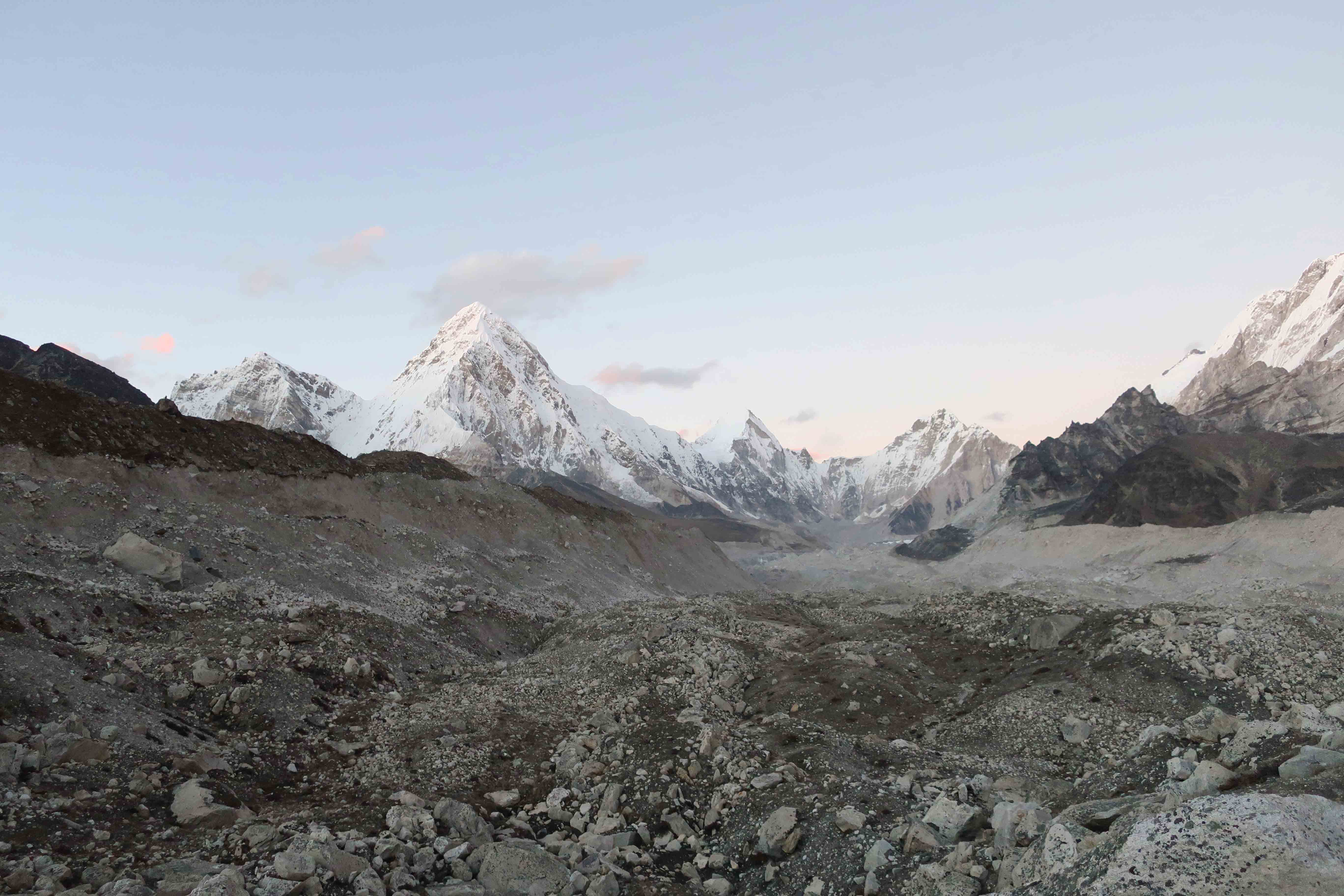
The Kongma La Pass crosses the Khumbu Glacier before you finally reach Lobuche. Exhausted from the ascent (even after the break), we commenced our descent from the pass and towards the moraine.
Looking down from the top of the pass, it seemed the way down would be an easy walk, and the moraine didn’t look that challenging either, but appearances, as they say, can be tricky. The way down was exactly how the Lonely Planet described it – “a never-ending descent over loose rocks.” It looked easy from the top, but walking on rocks that are sliding from under your feet while trying not to fall or knockdown other trekkers with falling rock proved to be a very challenging task.

Exhausted from the hike and beaten up by the altitude, we finally reached the glacier foot as the sun was beginning to set. In preparation for the last push, we took a short break, powered up with some energy bars and, with whatever strength we had left, started a series of mini ascents and descents.
The final push: crossing the Khumbu Glacier
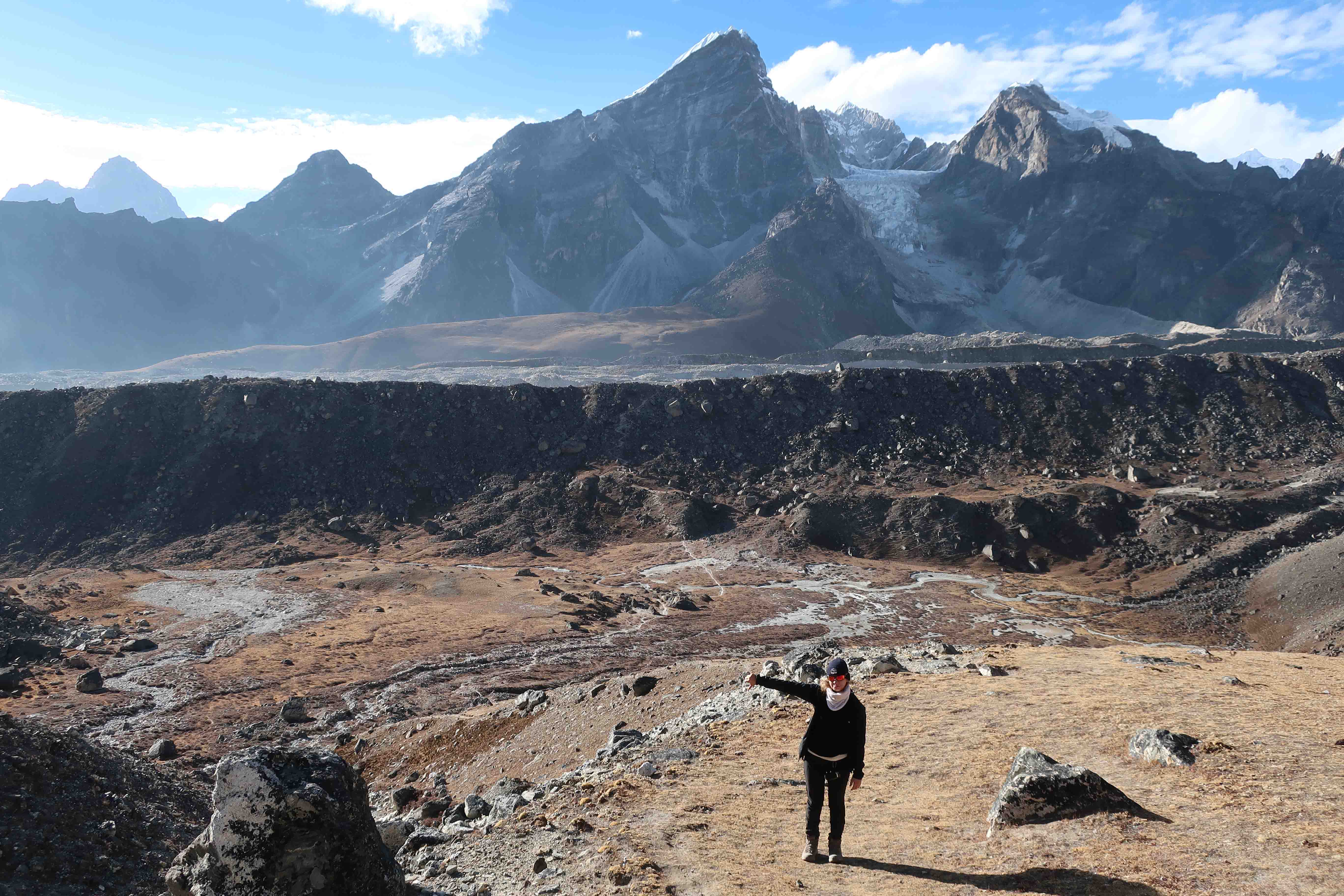
The final part of the Kongma La Pass is the crossing of the Khumbu Glacier. This last part is when a few trekkers got lost and had to spend the night in the moraine, so we took extra caution in finding the trail markings ahead.
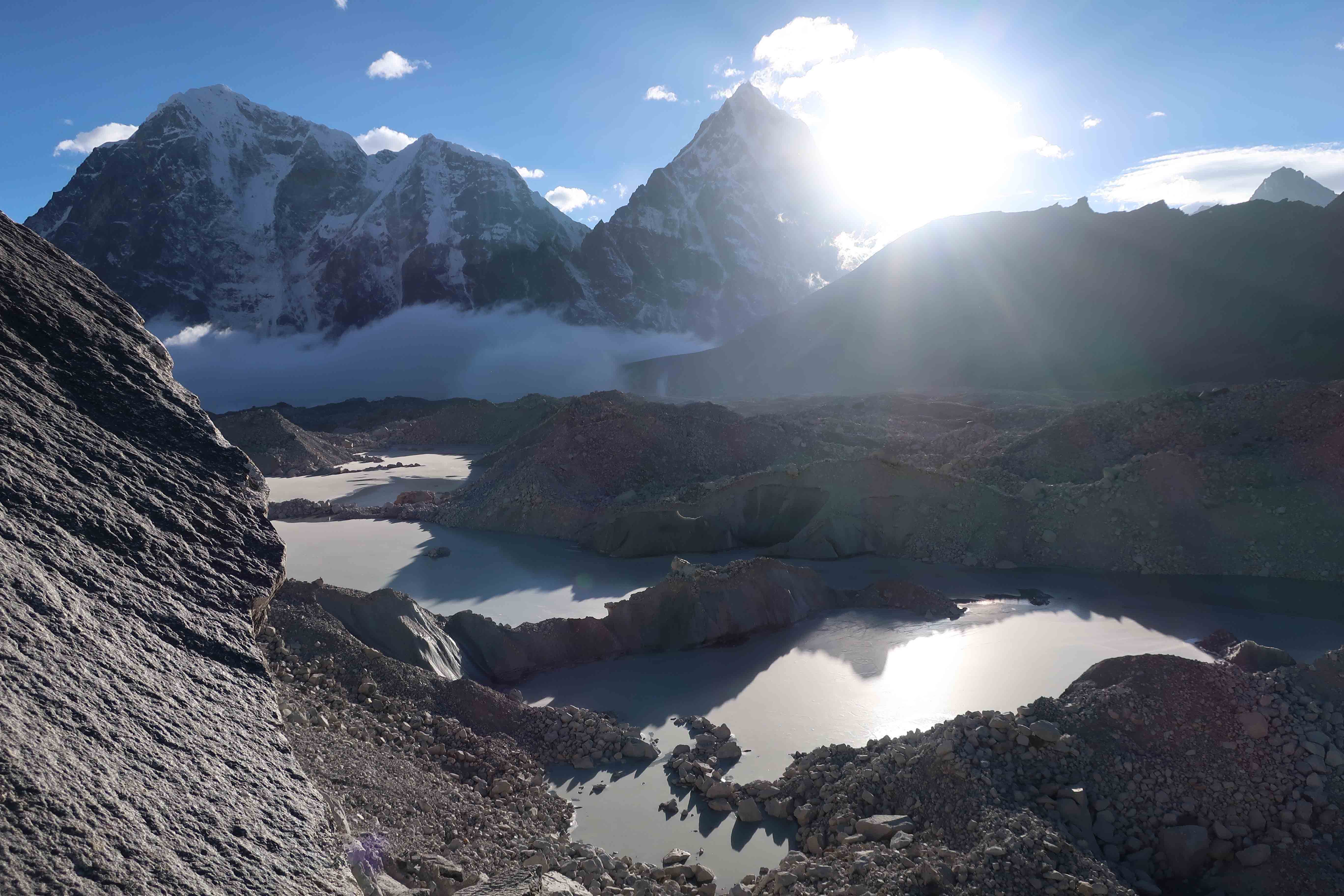
The Lonely Planet Nepal does mention that this is the part that may get confusing as the trail markings can easily blend in with a field of boulders. Glacier lakes to your left and your right and fields of grey rocks make it very hard to see where the safest path is. This part of the trek could easily pass for a lunar surface (minus the water), tons of grey rock and zero vegetation and the surrounding mountains make it look extraterrestrial and mesmerizing.
As you complete your first ascent and the views of a boulder field lie ahead, the path splits into two, only one of which is mentioned in the guidebook, the one to the right. That path, though, freaked a group of trekkers ahead of us as it brought them to a steep drop into a glacier lake, which at first seems like a dead end.
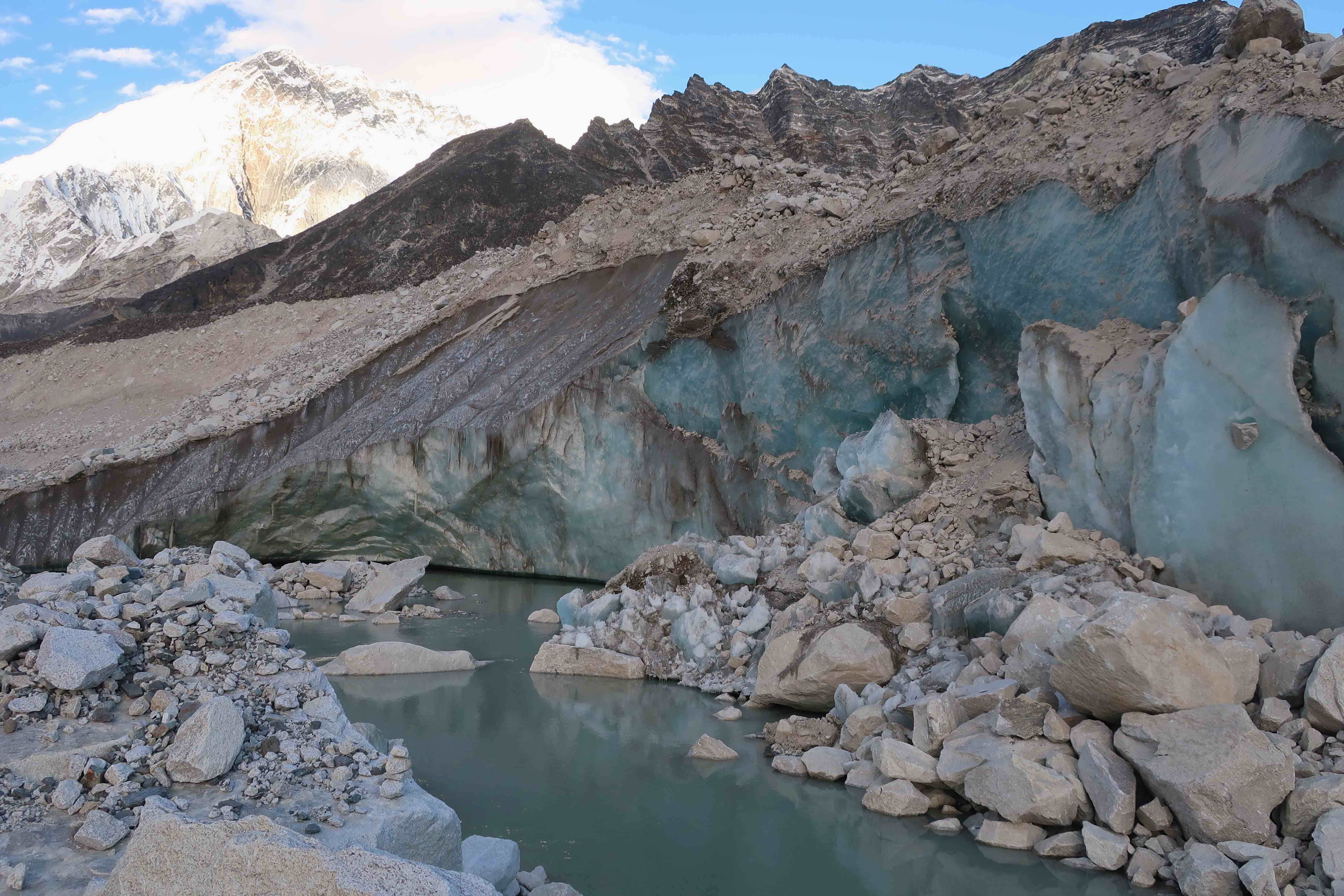
They turned around to look for the path anew, we (confident that we’re just not seeing it) continued looking for the way mentioned in the Lonely Planet and our GPS. After a few minutes, we spotted the path – slightly to the right, zigzagging down a field of rocks, a faint way led us down to a bridge made of stepping stones that cross a glacier creek. Some jumping is required, and you better not fall in ice-cold water, but it looks more challenging and dangerous than it actually is.
Travel Tip: The way we took was the one that the guidebook mentioned and the correct trail. However, we later learned of a shortcut – a bridge to cross the glacier lake built out of stones by the Nepali for the trekkers. Most trekkers found the bridge (which was to the left, and we went to the right) so you could inquire ahead or stick to a group with a guide to find that bridge.
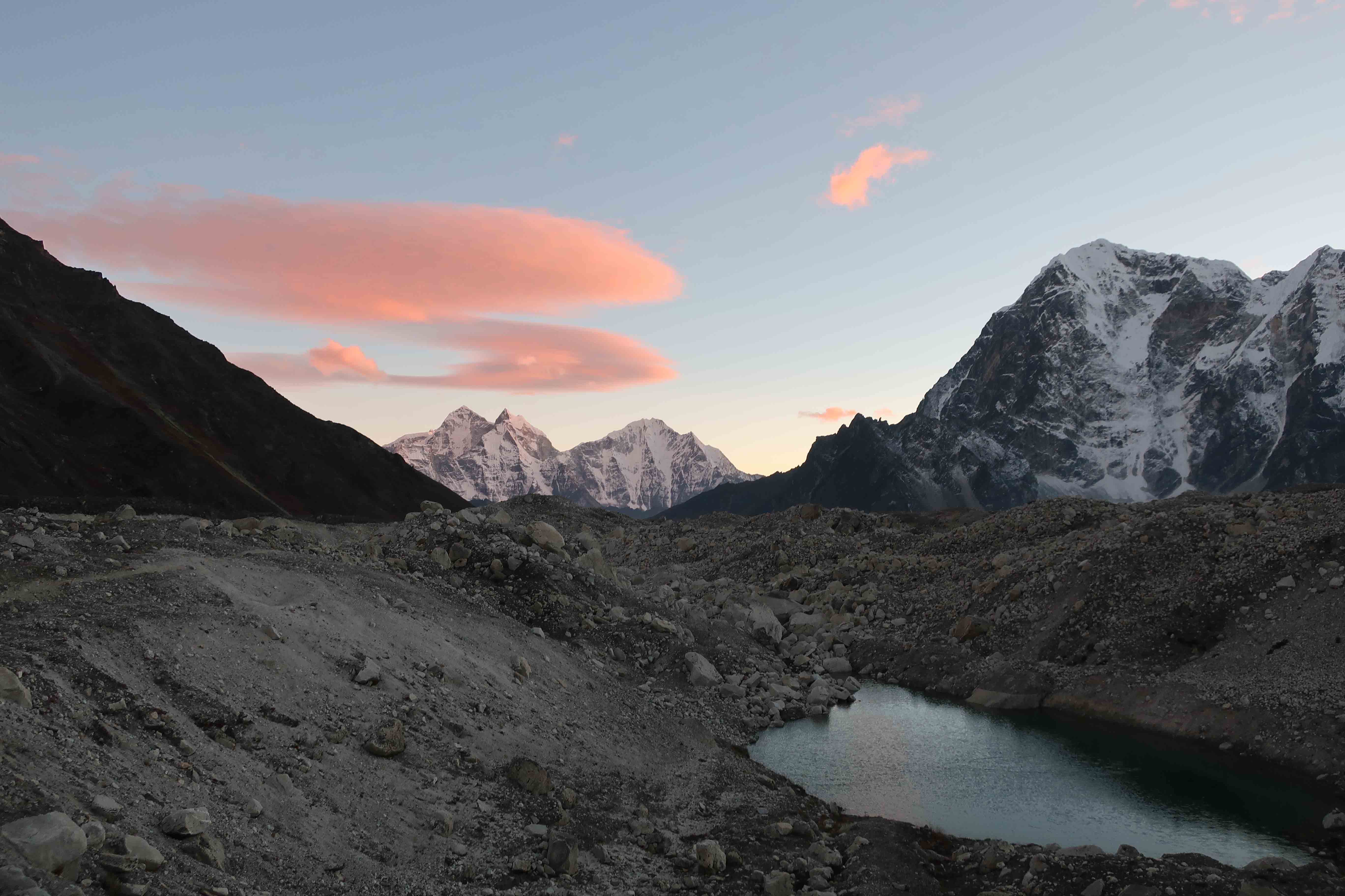
It was already getting dark when we were in the last part of the moraine crossing when we suddenly heard our names called out from not too far. It turns out, our porter and a guide came looking for us thinking we got lost. Exhausted and happy that we did it, we followed the guys to the lodge to pick up our bags. The Oxygen Altitude lodge, where our bags got dropped off, didn’t have any rooms available, so the owner called up the Everest View Lodge teahouse nearby, and they took us in.
Travel Tip: If you’re travelling in the busy season as we did, you may have issues finding accommodation in Lobuche and Gorakshep unless you plan ahead. Our Chukhung lodge owner offered to inquire with his sister in Lobuche about lodging for our stay. This was very helpful, considering we hired a porter to help carry our bags. So inquire in Chukhung about your accommodation in Lobuche and ask your teahouse owners in Lobuche if they could arrange a room for you in Gorakshep.
However, they only had two single rooms, which is what the owner gave us, but we cuddled up in the same room in the same small bed. It was a little tight but warm and better than sleeping in separate rooms after such an adventure (it was our honeymoon after all). AMS hit me hard that night. I was in too much pain and too nauseous to eat anything but Ibuprofen. This was the first time we came very close to abandoning the whole trek. It’s important to pay attention to how you’re feeling and go at your own pace because altitude sickness can creep when you least expect it. Once the pain let go, I slept.
Thankfully, the morning after, I felt way better but needed one more day to recover, so we decided to spend an extra night in the Oxygen Altitude teahouse. The rooms there are nicer, but the toilets are cleaner in the Everest View Lodge. The following day was for eating lots of Rara Noodle Soup (a Nepali version of instant noodles I discovered) and gathering strength for the rest of the trek.
Read next:
Everest Base Camp Trek Series:
View All Posts
- Day 1 – Toronto to Kathmandu
- Day 2 – Exploring Kathmandu
- Day 3 – Kathmandu to Lukla
- Day 4 – Namche Bazaar
- Day 5 – Namche Bazaar to Tengboche
- Day 6 – Tengboche to Pangboche
- Day 7 – Pangboche to Dingboche
- Day 8 & 9 – Dingboche to Chuchung
- Day 10 – Chuchung to Lobuche (over the Kongma La Pass)
- Day 11 – Lobuche (and the Italian Pyramid)
- Day 12 – Gorakshep to Everest Base Camp
- Day 13 – To Kala Patthar and Dzongla
- Day 14 – To Dragnak (over Chola Pass)
- Day 15 – Gokyo (with Gokyo Ri ascent)
- Day 16 – Back to Namche Bazaar
- Day 17 – Namche Bazaar to Lukla
- Day 18 – Lukla to Kathmandu
- Day 19 – Kathmandu to Toronto


2 Comments
tooseyhce74
Круто, давно искал
Alena
У вас замечательные статьи . Спасибо , Виктория .
Вот только я не нашла ваш первый день путешествия . Подскажите как его найти . Спасибо .